Overview
Surveyor is a precision aerial mapping platform built around a 45 MP global-shutter mapping camera and an integrated multi-band RTK GNSS. Designed for surveyors, civil engineers, construction managers, and GIS professionals who need PPK/RTK-grade cm-accurate orthomosaics and digital surface models. Optional multispectral and LiDAR payloads expand the platform to agriculture, forestry, and corridor mapping.
Mission Profile
- Cadastral and topographic surveying
- Construction site progress monitoring and earthworks volumetrics
- Mining and aggregate stockpile measurement
- Corridor mapping (rail, road, pipeline) with LiDAR option
- Precision agriculture with multispectral payload
Key Specifications
| Parameter | Value |
|---|---|
| Takeoff weight | 1.95 kg (mapping camera) / 2.4 kg (LiDAR) |
| Diagonal wheelbase | 460 mm |
| Max flight time | 45 minutes (mapping cam) / 38 min (LiDAR) |
| Max horizontal speed | 18 m/s |
| Max wind resistance | Level 6 (13.8 m/s) |
| Coverage rate | up to 2 km² per flight at 3 cm GSD |
| Vertical accuracy (RTK) | ±2.5 cm + 1 ppm |
| Horizontal accuracy (RTK) | ±1.5 cm + 1 ppm |
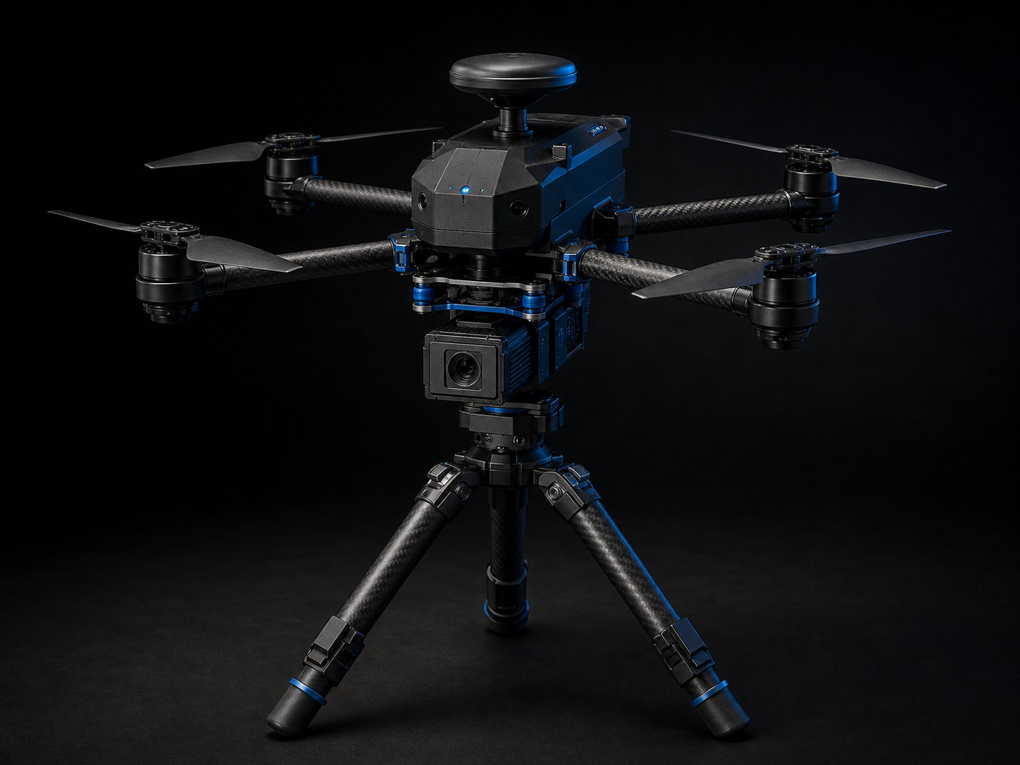
Camera & Sensor Payloads
- Garudeus MapCam-45 (standard): 45 MP APS-C global shutter, 28mm-equiv fixed lens, mechanical shutter
- Garudeus MultiSpec-5 (option): 5-band multispectral (R, G, B, RE, NIR) for NDVI / NDRE
- Garudeus LiDAR-16 (option): 16-channel solid-state LiDAR, 100m range, ±2cm point accuracy
- Garudeus Oblique-5 (option): 5-lens nadir + 4-oblique mapping head
Propulsion
- Brushless 3508 motors, 700 KV, US-wound
- 40A ESCs, US-assembled
- 13” folding low-noise propellers
Flight Controller & Avionics
- Garudeus Atlas-2 Pro — dual STM32H753, US-assembled
- Triple-redundant IMU, dual barometer
- Multi-band GNSS (L1/L2/L5 + Galileo + BeiDou + QZSS) with RTK/PPK
- AeroLink OS-Survey — automated mission planning (cross-grid, terrain-follow), camera-trigger sync
Communications
- Garudeus AeroLink Pro — encrypted 2.4/5.2/5.8 GHz
- 15 km transmission range
- RTK corrections via internal NTRIP client or Garudeus Base
Compliance & Certifications
- NDAA Section 848 compliant
- Blue UAS Cleared listing in progress
- FAA Remote ID compliant
- FCC, IC, CE, UKCA, RCM
- Designed and assembled in Moreno Valley, California
Operating Envelope
Daylight VFR. IPX3 splash resistance. Terrain-follow mode for steep terrain.
What’s in the Box
- Surveyor aircraft
- Garudeus MapCam-45 (standard payload)
- Garudeus RC-Pro controller with 5.5” display
- 2× TB55 Smart Batteries
- Parallel charging hub
- Garudeus RTK Base Station (included at this tier)
- 3× pairs propellers
- Pelican 1620 transport case
- Garudeus PhotoMission software license + 12-month Garudeus Map Cloud subscription
Available Accessories
- MultiSpec-5 payload: $4,499
- LiDAR-16 payload: $7,999
- Oblique-5 mapping head: $5,999
- Additional TB55 battery: $349
- Extended Garudeus Map Cloud (50,000 ha/year): $1,499